• Skip to primary navigation
  • Skip to main content
  • Skip to footer

Door County Green Fund

  • Grants
  • Multi-Modal Trails
    • Project Overview
    • Task Force Report
    • Trail Maps
  • Learn More
  • Support

Trails

May 8, 2024 by admin

Multi-Modal Trail Maps

Nestled along the scenic shores of Lake Michigan, Door County boasts an incredible network of trails that wind through breathtaking landscapes, charming communities, and natural wonders. We are proud to present a comprehensive collection of trail maps that will guide you on unforgettable adventures.

The creation of this trail map collection represents a vision for enhanced collaboration among the various entities responsible for public lands throughout the Door County peninsula. Realizing a truly seamless and interconnected trail system will require continued cooperation and coordination among local governments, organizations, and engaged citizens working together toward this shared goal.

Explore these trail maps to plan your next outdoor adventure and discover the natural treasures of Door County. But more than that, we hope this resource fosters a spirit of collaboration by providing insight into the current trail initiatives of our community partners as well as their future plans. With open communication and a shared vision, we can unite efforts to create a cohesive trail network across the peninsula for all to enjoy.

The Door County Community Foundation, and its component fund the Door County Green Fund, expect to be entertaining requests for funding from the non-profits and municipalities that will further this work. Consequently, Destination Door County has generously agreed to take a central role in helping move this effort into its next stage. To get involved, contact Amanda Stuck at amanda@doorcounty.org.

Town of Baileys Harbor
Village of Egg Harbor
Village of Ephraim
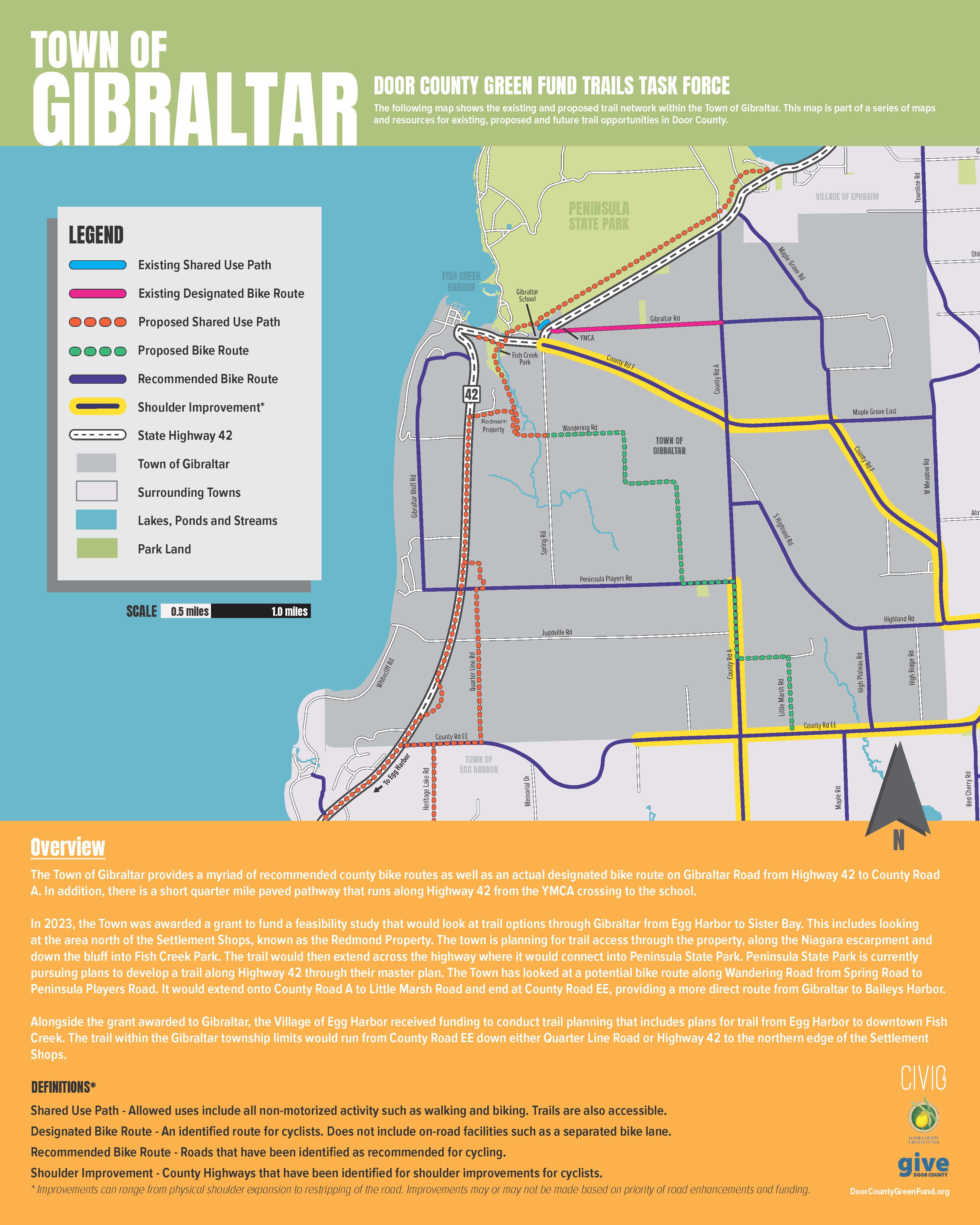
Town of Gibraltar
Town of Jacksonport
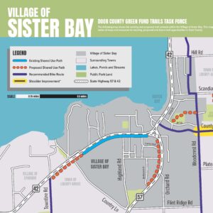
Village of Sister Bay
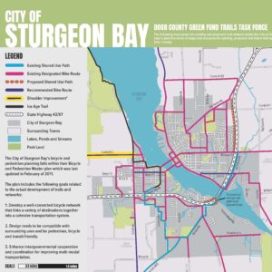
City of Sturgeon Bay
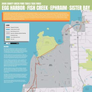
Egg Harbor, Fish Creek, Ephraim, Sister Bay
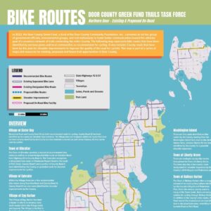
Bike Routes - Northern Door
Bike Routes - Southern Door
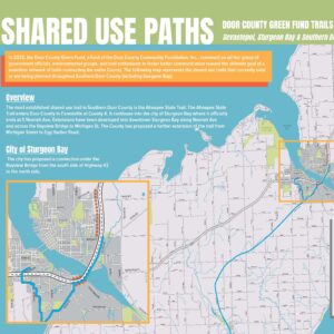
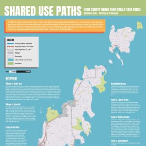
Shared Use Paths - Northern Door
Shared Use Paths - Southern Door
Comprehensive Map
Project Introduction
Project Overview
Task Force Report

Filed Under: Trails

May 8, 2024 by admin

Multi-Modal Trails Task Force Report

The Door County Multi-Modal Trails Task Force’s primary goal was to develop a comprehensive map of all trail-related projects, both existing and planned, throughout the entire county. The purpose of the map would be to provide information to communities to aid in the development of trails. This included reviewing all current bike and trail plans as well as reaching out to all 19 municipalities for information on what trails they maintain or are planning to develop in the next 5, 10, and 20 years.

The project was not meant to be a new plan for what communities “should” be doing. The task force recognized that communities are already pursuing projects and have plans in place. The group decided the best course of action to provide support for trail initiatives would be to help inform all communities of what’s going on across the county to connect people who may not be connected otherwise.

Therefore, the maps that have been developed are consistent with all current plans that are in place and reflect only those projects that are actively being discussed by the municipalities or organizations that are responsible for pursuing them.

The Door County Community Foundation, and its component fund the Door County Green Fund, expect to be entertaining requests for funding from the non-profits and municipalities that will further this work. Consequently, Destination Door County has generously agreed to take a central role in helping move this effort into its next stage. To get involved, contact Amanda Stuck at amanda@doorcounty.com.

Download the Multi-Modal Trails Task Force Report
Project Introduction
Project Overview
Multi-Modal Trail Maps

Filed Under: Trails

May 8, 2024 by admin

Multi-Modal Trails Project Overview

Our community is home to an abundance of dynamic trails used by walkers, hikers, and bikers alike. However, between 19 municipalities, 5 school districts, and countless non-profit organizations, coordinating the stewardship of our trails can be difficult. In 2022, the Door County Green Fund, a fund of the Door County Community Foundation, Inc., convened an ad hoc group of government officials, environmental groups, and trail enthusiasts, to foster better communication toward the ultimate goal of a seamless network of trails connecting the entire county.

Phase I – Information Gathering

In the first phase of the project, it was important to connect to all municipalities and relevant stakeholder organizations to not only inform them of the project but also to understand what trails exist and what trails might be developed in the future. It was important to gather this information directly from those responsible for trail development. The following table shows all communities and organizations that were contacted and the responses they provided. This information was used as the basis for developing all maps.

Phase II – Map Development

Phase 2 began once enough information was collected to begin laying out the comprehensive map. The design came together using information from each municipality as well as base map layers acquired from stakeholders. The initial comprehensive map came together with all the information collected and was presented to the task force in November 2023. The task force was able to make suggestions for changes including additions based on new information received and removals for initiatives that had either changed or were no longer moving forward. The task force also outlined additional maps to be developed using the comprehensive map as a base. These included close-up maps of each municipality as well as maps that showed a breakdown of trails vs. cycling routes for both Northern Door County and Southern Door County.

Phase III – Reviews and Revisions

Based on the task force’s review of the initial comprehensive map there were multiple new maps to create that could be used by each municipality to pursue their own trail initiatives. The bulk of the new maps included close-ups of the following communities:

• City of Sturgeon Bay
• Village of Egg Harbor
• Village of Ephraim
• Village of Sister Bay
• Town of Gibraltar
• Town of Baileys Harbor
• Town of Jacksonport
(View all Trail Maps Here)

Each of these close-up maps was sent to the appropriate contact or administrator for review and feedback. Feedback was received from all communities and edits were made to ensure that the information presented on each map was verified and correct. The review process also helped to ensure that each community was comfortable with the information that was presented on each map in regard to being able to speak to the map should questions or comments arise from community members in the future.

In addition to the close-up maps the task force wanted to see maps depicting the trail connections being planned from Egg Harbor to Sister Bay. A map was developed showing the four communities involved including: the Town of Gibraltar; and the Villages of Egg Harbor; Ephraim; and Sister Bay. The boundaries ranged from Frank Murphy County Park (located in the Town of Egg Harbor) to Waters End Road, just north of the Village of Sister Bay’s northern limits.

Phase IV – Future Planning

The maps that have been developed through the Door County Green Fund are resources for municipalities and community members to use in the development of the trail network. These resources can help each community plan for and move forward with trail development over the next 5-20 years.

The Door County Community Foundation, and its component fund the Door County Green Fund, expect to be entertaining requests for funding from the non-profits and municipalities that will further this work. Consequently, Destination Door County has generously agreed to take a central role in helping move this effort into its next stage. To get involved, contact Amanda Stuck at amanda@doorcounty.org.
Project Introduction
Task Force Report
Multi-Modal Trail Maps

Filed Under: Trails

May 7, 2024 by admin

Multi-Modal Trails

In the summer of 2022, Pamela Wattenmaker approached the Door County Community Foundation with an idea. She imagined a Door County in which it was easy for someone to walk from their home on the outskirts of town into the shopping areas downtown. She envisioned a system of trails that went from one village to the next, from one town to another. The challenge, of course, is how to bring that vision into reality.

As a result, under the auspices of the Door County Green Fund, a fund of the Door County Community Foundation, Inc., an ad hoc group of citizens, government officials, non-profit organizations, and local businesses began meeting to expand on that original vision and see if there were tangible steps that could be taken to move it forward. The team that formed had no defined membership roster, no formal standing, and no specific mandate. Rather, these were just people who shared the vision of an interconnected trail network for walkers, joggers, bikers, and the like. The team grew organically, as members identified and invited others who shared their enthusiasm for this work. Everyone was welcome.

The team began by looking at previous efforts to map out a multimodal trail system in Door County and even entered into discussions with several national consulting firms that could guide such a county-wide process. However, it was readily apparent that in other places in the country where such an interconnected system exists, the trails typically were located within a single municipality or involved just a small handful of units of government. That made it relatively straightforward when creating a shared vision. In Door County, such a county-wide interconnected multimodal trail network would likely require the coordinated effort of 1 county, 1 city, 4 villages, 14 towns, 5 school districts, and countless non-profit environmental organizations that control public lands.

Rather than try to define a shared vision, the team instead decided to collect and document the individual visions of all these public landowners in Door County. The goal is to help individual municipalities and organizations better understand what their neighbors are doing today, and what they plan to do in the decades ahead, in the hope that the players will come together themselves in a spirit of collaboration. If you know where your neighbor plans on building a new trail in the next decade, you might be more likely to alter your own future trail plans to enable them to connect.

The team’s greatest hope is that this document will foster greater conversation and collaboration between those entities that control public lands on the peninsula. If Door County is ever going to truly realize an interconnected trail system up and down our peninsula, it will ultimately take the efforts of individual units of government, and their citizens, all working together.

The Door County Community Foundation, and its component fund the Door County Green Fund, expect to be entertaining requests for funding from the non-profits and municipalities that will further this work. Consequently, Destination Door County has generously agreed to take a central role in helping move this effort into its next stage. To get involved, contact Amanda Stuck at amanda@doorcounty.org.
Project Overview
Task Force Report
Multi-Modal Trail Maps

Filed Under: Trails

Footer

The Door County Green Fund
is a fund of the
Door County Community Foundation, Inc.
222 N 3rd Ave
Sturgeon Bay, WI 54235
(920) 746-1786
  • Grants
  • Multi-Modal Trails
  • Learn More
  • Support

Copyright © 2025 Door County Community Foundation